Case Study – River Liffey Water Sensors

River Liffey Water Sensors – A Smart City Case Study
The River Liffey is one of Dublin’s most iconic landmarks, flowing through the heart of the city and serving a wide range of users, including boat tour operators, local businesses, and even kayakers! Yet until recently, there was no live data available to help understand how the river behaves in real time.
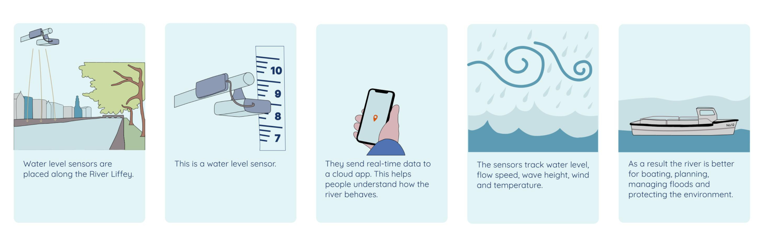
The River Liffey Water Sensor Project is a smart initiative designed to monitor water levels, flow, temperature, and wave activity across key points of the Liffey. Using advanced radar sensors called Pixel II, the system provides accurate, real-time data that can be accessed via a cloud-based app. These sensors are compact, highly durable, and capable of measuring water levels with millimetre precision, in any weather conditions.
The project addresses several important challenges surrounding urban water activities. For recreational users, knowing the water velocity and wave height can mean the difference between a safe outing and a risky one. For commercial operators, live data helps determine bridge clearance and turning space, improving safety and efficiency. For city departments, the sensors offer valuable insights into flooding risks, infrastructure planning, and environmental monitoring.
Once installed, the system sends alerts when water levels are unusually high or low – helping users make informed decisions and avoid hazards. Over time, the data will also build a clearer picture of how the river behaves, supporting long-term planning and environmental stewardship.
This initiative is about more than just deploying technology, it is about making the Liffey more accessible, safer, and better understood by everyone who interacts with it.
Check out the live Liffey Water dashboard here!